Te Ara Moana - Day 1 (Tamaki Strait)
Background
Te Ara Moana (the Sea-going Pathway) was one of the Maori routes where they were transfering food and goods. It’s a five-day paddling if you want to go the whole path. There are camping sites along the way that are not accessible by cars, hence, sea kayakers (and some hikers) can have them for themselves! You can find more information in the Auckland Council website (Download the PDF, there are more details there).
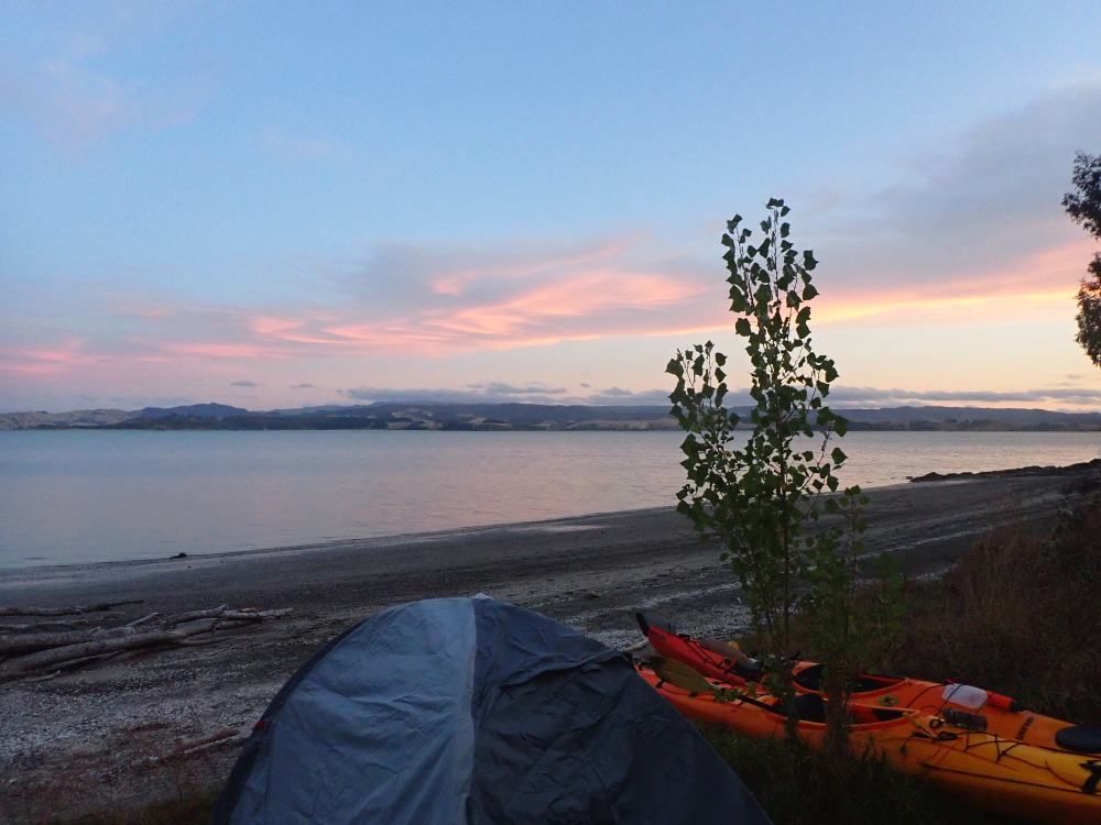
We went the first day, camped, and went back the same route.
Car park
You can park your car in Omana Regional park, or Omana Beach. If you’re parking in the park, drop a note in the box in the ranger’s office.
Tides
Make sure you will arrive at your camp ground around three hours after or before low tide. The beach is muddy at low tide.
Route
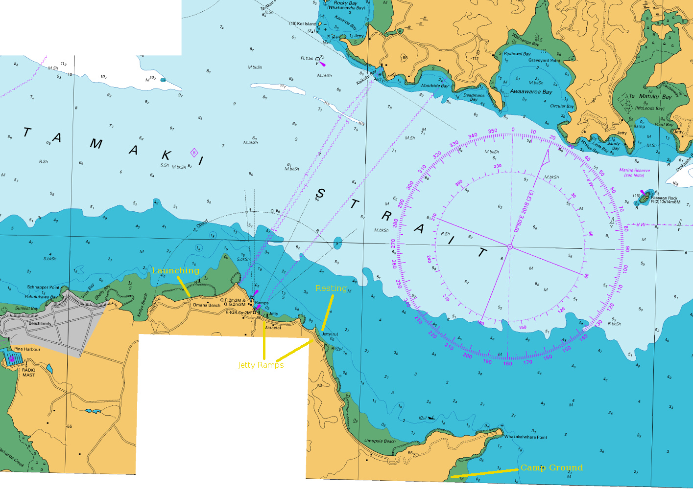
It’s a little more than 6 nautical miles from Omana beach to the first campground in Duder park. For us, it took about two hours to paddle there, including a short rest in the middle of the way.
Simply, follow the coast to the south and enjoy beautiful scenery! The Whakakaiwhara Point is very obvious. After going around that, paddle close to the shore for finding the campground. There’s a sign above the campground that is not very obvious, but can be seen.
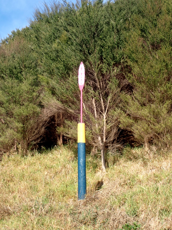 The campground sign you should look for
Hazards
The sea is well sheltered by Waiheke Island. It’s really calm in a good weather. The only hazard is other boats and jetskis. Legally, they should move with less than 5 knots speed when they are less than 200 meters from the shore. Stay closer to the shore near Jetty ramps.
Chart
You can download the chart of Te Ara Moana (day 1) from LINZ website.
